Empowering Advanced Emergency Response
In the era of rapid technological advancement, leaders in the utilities sector are continually looking for innovations that promise to reshape and redefine their landscape. The combination of Unleash live’s cloud platform and Ground Control Station (GCS) application known as Autofly brings such transformative solutions alive with its forward-thinking features designed to bring unprecedented efficiency, safety, and precision to emergency response.
Real-time Emergency Response
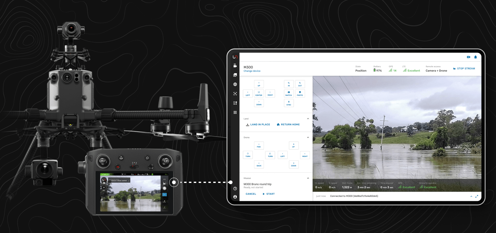
Autofly stands out for its unique capabilities, with its zero-latency live streaming accommodating multiple devices, including drones and body-worn cameras (or any connected device). This enables a comprehensive, real-time view of the situation on the ground, an invaluable asset for swift decision-making during disaster scenarios.
Further enhancing communication efficiency, Autofly provides real-time two-way audio, facilitating clear and direct communication between ground personnel and the command center. In addition, the system's integration with Astra UTM effectively deconflicts airspace, paving the way for safe coordination between crewed and un-crewed aircraft.
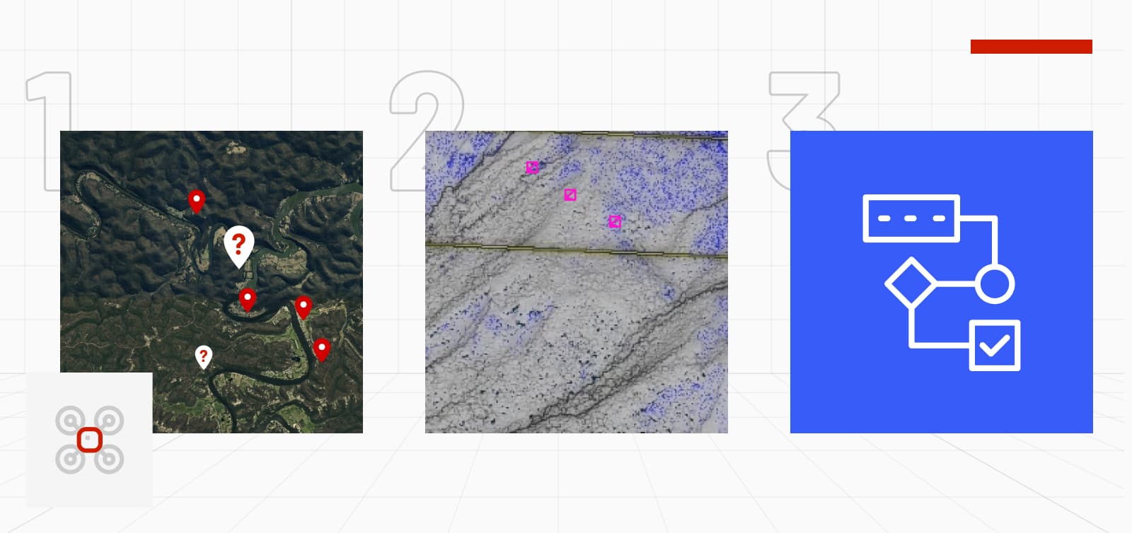
Geographic Information System (GIS) Integration with Fusion Atlas
Unleash Live's Fusion Atlas revolutionizes spatial intelligence in emergency response. This advanced GIS tool allows instant sharing of marked areas of interest between the command center and pilots. Real-time pin dropping from GCS through a laser range finder or manual inputs is feasible and instantly viewable in the cloud platform.
Furthermore, Fusion Atlas provides a holistic view of all drone operations over a map, complete with integrated live streams. This connectivity significantly expedites decision-making. The link between pilots and command centers is a game-changing development ready for deployment.
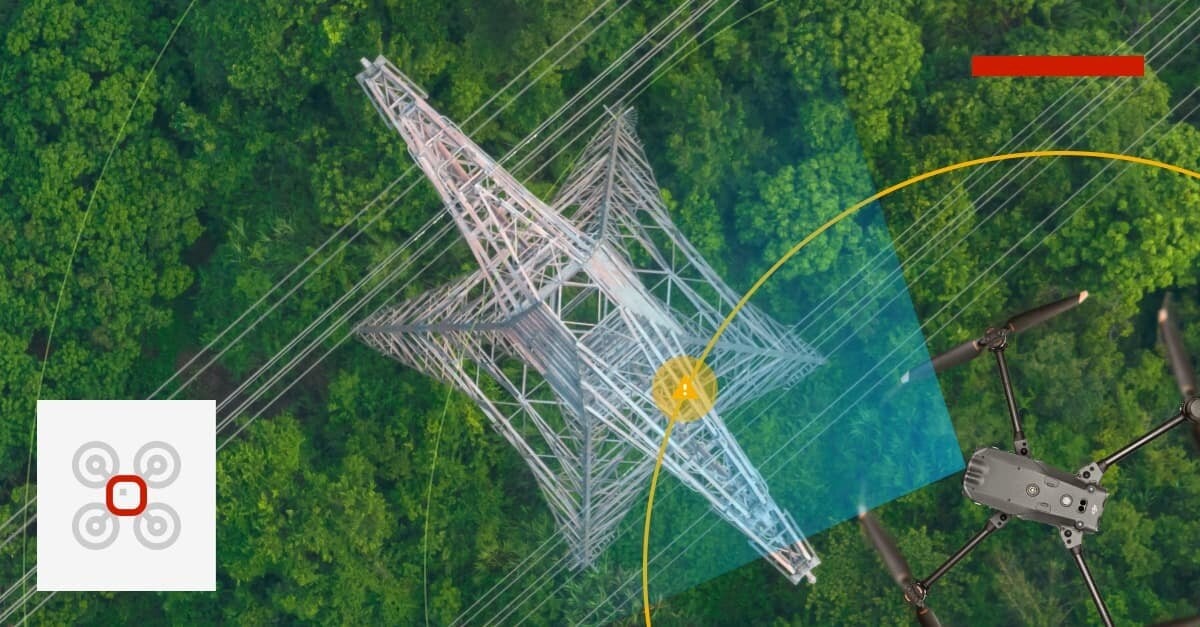
The Power of Autonomy and A.I.
Utilities are embracing Autofly's capabilities for executing automated missions. This feature allows for the precise, repeatable inspection of assets, such as distribution poles, which can be executed from either the drone pilot or the command center. The consistency and repeatability of these automated inspections ensure standardized data collection, enabling more accurate trend analysis over time, no matter who is operating the aircraft.
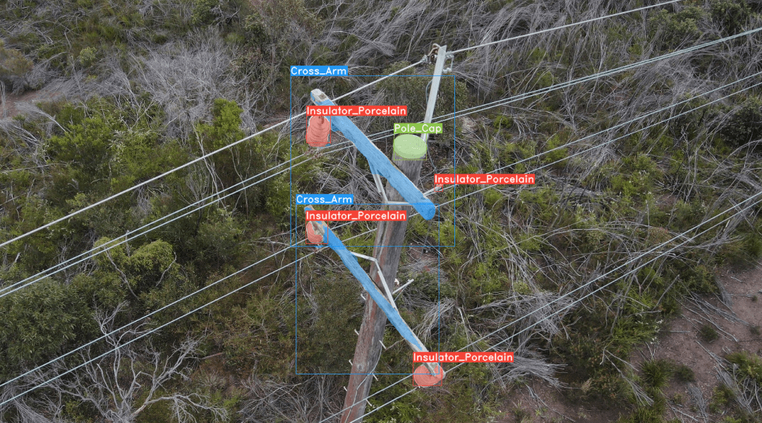
Equally impressive is Autofly's integration with advanced A.I. models. These models assist in identifying components and detecting faults, accelerating the process of damage assessments. A.I.'s capacity for high-speed pattern recognition and data analysis allows potential issues to be identified and addressed more swiftly than ever, saving valuable time and resources during critical emergency responses.
Automated power pole component detection with Unleash live's A.I. Apps
Conclusion
With its advanced suite of capabilities, Autofly is transforming how the utility sector manages and inspects assets. By seamlessly integrating real-time multi-device streaming, remote drone control, GIS integration, automated missions, and AI-assisted fault detection, Autofly sets unprecedented industry emergency response standards. It provides a glimpse into a world where efficiency, safety, and precision are taken to new heights.