City planners, security personnel, emergency services, and police authorities regularly require the ability to measure the movement of people and vehicles in a given environment, either for real-time response or for data collection to make more informed decisions.
Capturing this data has become as easy as ‘tripoding’ a mobile camera or leveraging existing city cameras, activating an Unleash live account, and live streaming the video with the applicable AI app.
At Unleash live, we are building the tools necessary to measure reality on the ground accurately.
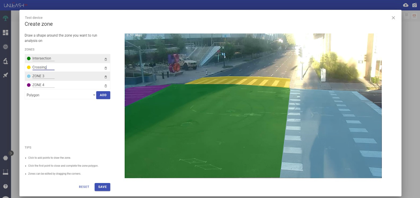
In many instances, the environment needs to be digitized to focus data capture on a given geospace. For this (and other reasons), we’ve built a new tool to create zones on an A.I. live stream.
There are two types of zones — the Polygon zone, designed to identify the count of objects within an arbitrarily designated region, and the Bi-directional zone, which counts the number of people or objects crossing a designated line.
Benefits of zone application
-
Ability to focus data capture on areas of interest
-
Exclude areas to increase accuracy
-
Zone-specific alerts. Become alerted when an instance happens in a given location
Focused Data Capture
Identify virtual zones to capture accurate data
Collect accurate and specific data on pedestrian traffic volume in a simplified, streamlined way. To collect the right data, clarity is required on what is actually being measured.
In the example above, the three colored zones allow us to understand the volume and movements between pavement and the street and exclude people walking into those zones from across the road. This allows for quite specific datasets perfect for understanding the flow and movement of people and vehicles over time.

Bi-directional count at transport
Additionally, a bi-directional count can be created to understand in & out scenarios. A very simple example would be toll gates, doors, or pathways.
Exclude Areas to increase accuracy
People and vehicles move in unpredictable patterns, so pinning down exactly what the goal of the exercise is may require exclusion zones to be created in the design phase.
With the example below, the zones created at each intersection ensure that only the movement of pedestrians is counted as they cross very specific crosswalks. All other movement is effectively left out of the data gathering.
Pedestrian count at crosswalk - city cameras
Zone specific alerts
Understanding the resources required to manage a given public situation is a changing requirement traditionally met with dedicated resources making regular subjective calls. Overcrowding or people detection within a given space can be handed over to a camera, with API, e-mail, and SMS integration for updates and alerts of predetermined anomalies.
Crowd monitoring within a defined zone
The example above indicates a significant show of force, some 50 police officers for only six or so protesters.
Whether managing protests or looking to secure a location from people or vehicle traffic, zonal applications can transform the application of limited resources.


