Prepare to witness your world in unprecedented detail as Unleash live introduces the latest enhancement to Fusion Atlas, setting a new standard in precision. Our cutting-edge 5cm GSD satellite imagery, strategically implemented in key areas, provides an unparalleled level of detail for your surroundings. This advancement empowers you to map assets with pinpoint accuracy, analyze infrastructure networks with laser-sharp focus and embark on a new era of data-driven asset management. Get ready to unleash the power of precision with Fusion Atlas.
Eagle-Eye View, Ground-Level Precision
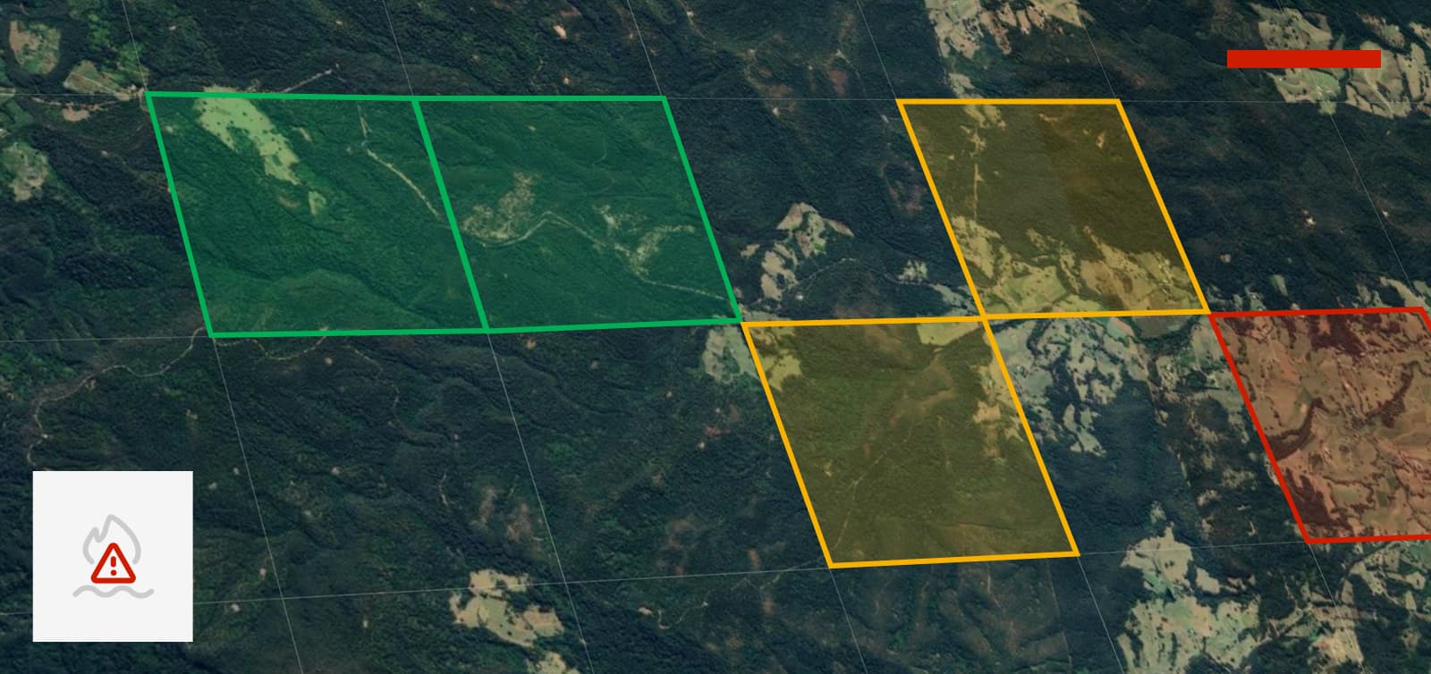
Take command of your entire asset portfolio geospatially - solar farms, pipelines, power grids etc, all can be presented as a detailed map, eliminating the need to sift through countless folders or decipher confusing coordinates.
Inspect with confidence - Identify erosion and vegetation with incredible clarity, thanks to the 0.05m GSD, enabling you to pinpoint issues without requiring sub-centimetre accuracy. Fusion Atlas seamlessly integrates this level of precision when necessary.
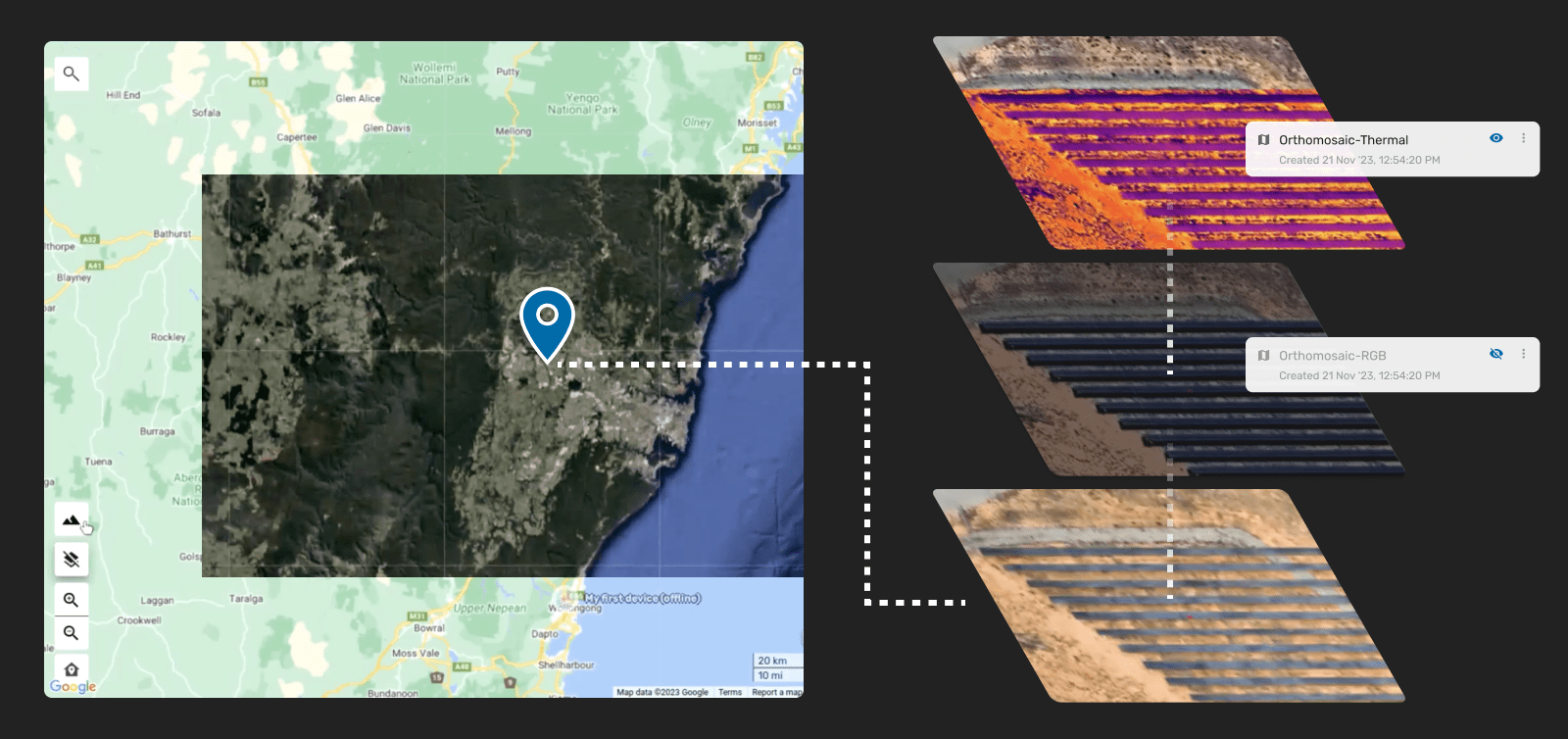
Generate custom 2D orthomosaics - If you need even higher resolution, Unleash live's flagship Autofly application allows you to capture drone imagery and generate georeferenced orthomosaics within the cloud environment. Overlay these on your base maps for sub-centimeter pinpoint precision.
Beyond Pixel-Perfect Images
Overlay inspection data - Plot inspection points, findings and work orders directly on your Fusion Atlas maps, eliminating the need for juggling separate platforms or relying on handwritten notes.
Streamline communication and response - Share pins, markers and reports instantly with field crews and colleagues, facilitating efficient resource dispatch by precisely identifying issue locations.
Switch between layers seamlessly - Toggle between satellite imagery, street maps or custom layers effortlessly, providing optimal visualization in any situation.
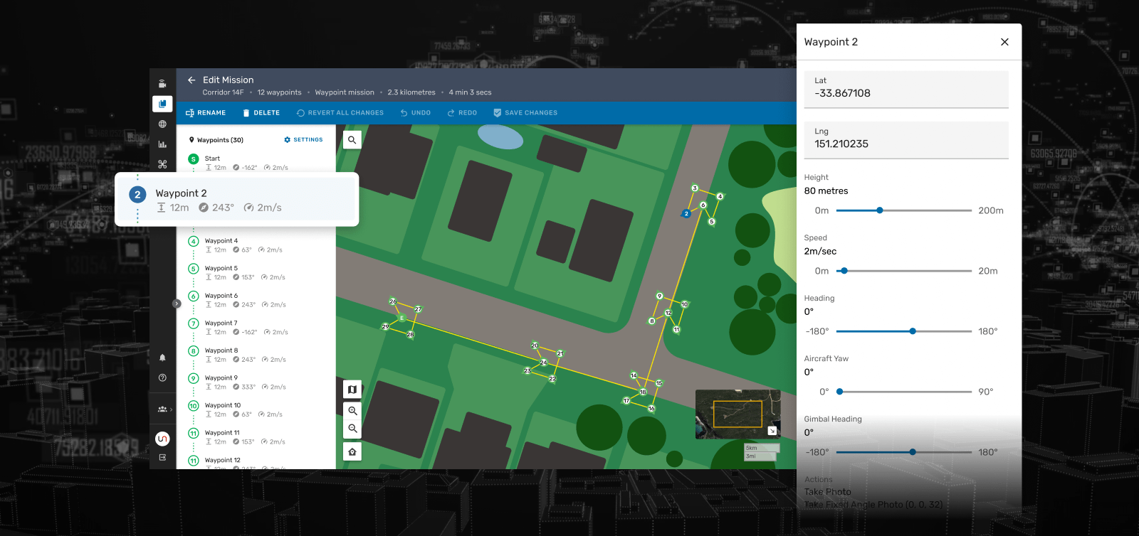
Synchronised Control Room and Pilot
Real-time collaboration - Pins and markers set in Fusion Atlas appear instantly on the Autofly app, ensuring that pilots and control room staff are always on the same page.
Precise targeting - Pilots can drop pins with a laser rangefinder, providing field crews with the exact location of issues directly from their mobile devices.
Beyond Inspections, Beyond Imagination
The high-resolution upgrade to Fusion Atlas marks just the beginning of our commitment to revolutionize asset management. Explore a wholistic inspection future with:
- Multi-asset inspections - Manage ALL your assets, from wind turbines to pipelines, in one central hub for comprehensive oversight.
- AI-powered analytics - Leverage AI to automatically detect anomalies and predict potential problems before they occur, taking proactive asset management to the next level.
- Drone operations and automation - Streamline your entire drone workflow, from mission planning to data analysis, ensuring efficiency at every step.
- Seamless integration - Fuse Fusion Atlas with your existing tech stack, such as ESRI, for a truly connected ecosystem, that maximizes your technological investments.
Ready to witness the transformative difference high-resolution satellite imagery can make? Contact Unleash live today and experience the future of asset management firsthand.