Customer Story: Back Burning Operations & Zero Latency Live Streaming

Back burning is a vital part of the work conducted by the fire service to ensure the safety of regions where extensive fuel may have built up. 

The operation itself can be dangerous due to the nature of the work. Setting off live fires is hazardous, and crews need to be on hand to monitor, control, and ultimately put out the controlled burn on the ground. 

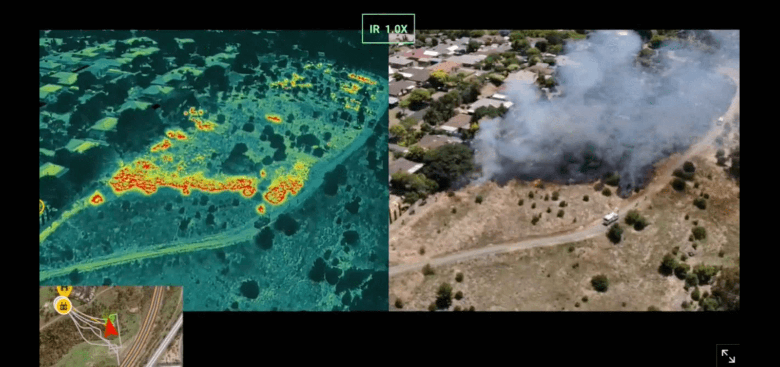
Situational awareness is critical to ensure crews understand what is happening in real-time. This is where live video and aerial thermal imagery become invaluable tools. 

In December 2021, Drone service provider R2F utilized Unleashlive Autofly to support planned back-burning operations for State Emergency Services South Australia and the Department of Water, Energy, and Resources (DEWR) in South Australia. 

Utilizing zero-latency aerial thermal and RGB footage from Unleash live, the on-site crews could better understand the burn area and patterns and identify any possible hotspots outside of the set burn area. 

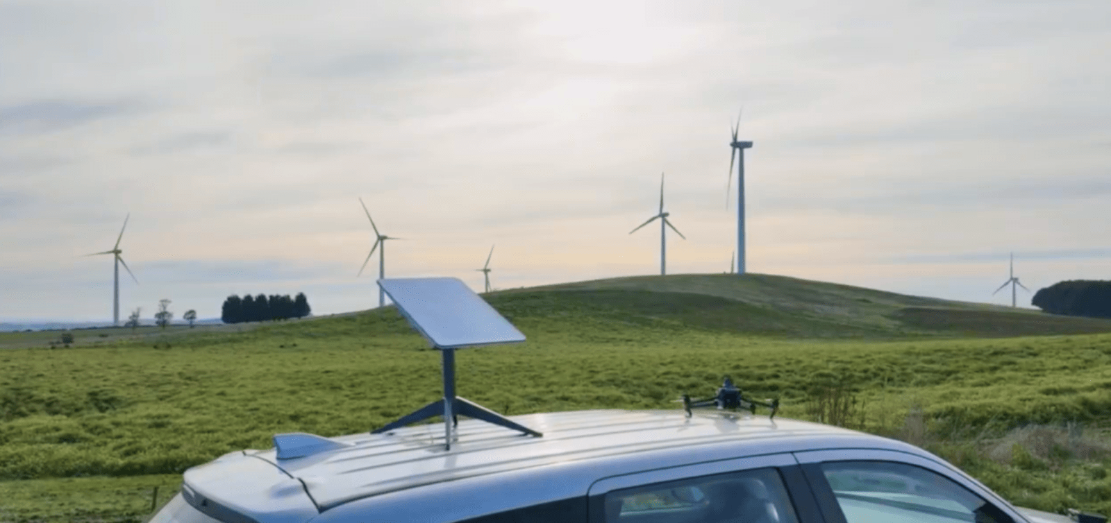
Connecting drones to Unleash live is fast, and R2F operators were able to quickly connect their flying crafts over 3/4G mobile networks (Note: Read about Unleash live support for Starlink), providing secure video streaming to their designated watch page. 

The Watch Page is a browser-based web page that broadcasts the live footage, enabling anyone with access to join the action on the flight. 

In preparation for the event, the R2F team created a unique QR code for the watch page and made it accessible via the mission briefing documents. This provided onsite crews to quickly gain access to the video and audio feed by simply using their phone or tablet. No software to download, no credentials, no complications.  

The application also allowed the operator to pinpoint the exact GPS coordinates of hotspots and areas of interest using the built-in Laser range finder to quickly and effectively deploy necessary ground crews. 


Remotely monitoring and co-ordinating back burning operations with Unleash live and both RGB and thermal drone imagery
 

Clear operational benefits: 

  1. Providing a broader base of crew and experts to observe the fire behavior and predict its direction 
  2. Improved targeting and deployment of resources - Whilst having firefighters on the ground, giving them the data for the command to direct resources to the hotspots 
  3. Faster and more effective mop-up phase as there is the potential for a flare-up by not identifying a hotspot

Setup Process:

The Unleash live Autofly application has been purposely built to allow emergency and first responder services to gain unprecedented situational awareness across their operations using connected devices. The system does not require any additional hardware to operate and runs natively on the DJI Smart controller and Android systems. 

  1. Download Autofly 
  2. Install Autofly on your GCS, ie Smart controller 
  3. Create a streaming device and URL
  4. Start stream 
  5. Share with stakeholders 

Features:

  • Stream live video and audio from the pilot and share it with stakeholders instantly 
  • Automatically record and save all streamed footage to your account to assist with mission debriefing, evaluation, and compliance.  
  • Pass control of the RPAS (drone) or camera payload to a remote operator for an instant “eye in the sky”

Benefits:

  • Setup and start streaming in less than 2 minutes.
  • Full control of your watch page.
  • Quickly provide ground crews with on-demand live video footage for better situational awareness and decision-making. 
  • Connect aerial and ground cameras to provide a complete picture of the situation.
  • Display multiple video feeds in one dashboard for centralized control. 

You can speak to us about Autofly for your operations here

R2F service clients all over Australia with an industry focus on the communications, natural resources, renewable, and energy sectors. They have a particular passion for projects that provide positive environmental outcomes, specializing in close-range sub-millimeter photogrammetry and asset inspection working with a network of survey professionals to deliver accurate aerial imagery of built environments and surface conditions.