Lidar vs. Photogrammetry - What’s the difference?
Drones get all the limelight, mainly due to their dazzling photography and video, however, Enterprises are now into the full thrust of using this visual data for actionable insights.
In recent years, there has been significant development and widespread use of aerial drone survey techniques with photogrammetry and LiDAR. This has caused a lot of confusion and misconceptions about the technologies, so we thought it best to break these down for you with their features, differences, and where each is best suited.
LiDAR
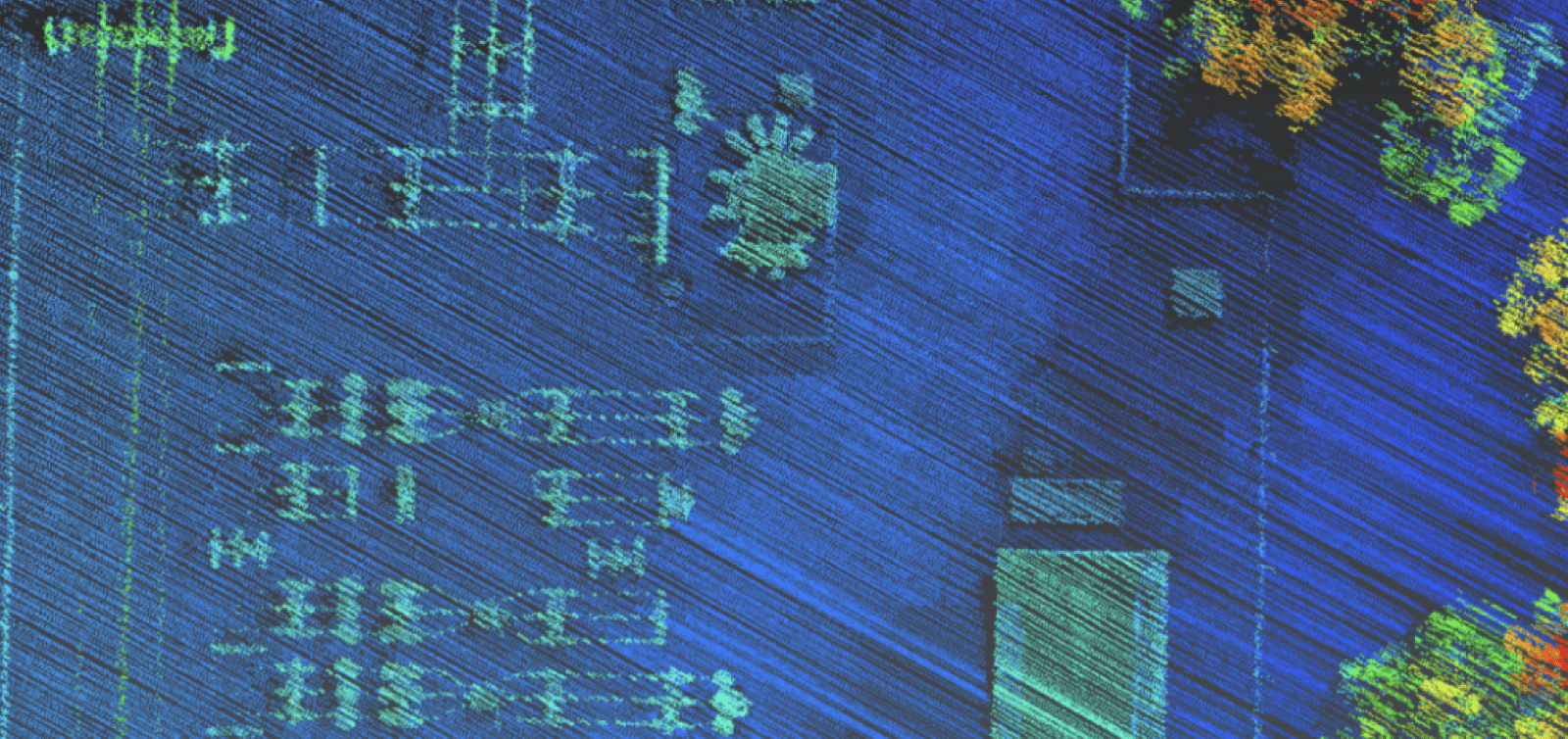
Light Detection and Ranging Technology, or LiDAR, started being used in the 1960s. LiDAR shoots out multiple lasers and measures the time each beam returns to the detector. This data is then used to generate a dense point cloud by deducing the distance and angle of each point from the LiDAR source and the exact position and orientation of the LiDAR payload through its scan time.
One of the main benefits of LiDAR is that it creates its own light source and is not dependent on environmental factors such as time of day, poor lighting conditions, or changing cloud shadows.
Another major benefit of LiDAR is its ability to measure multiple returns from a single laser pulse. This allows LiDAR to penetrate vegetation and record any partial returns it may have made as it makes its way to the surface below the vegetation. This multiple-return method also significantly increases the number of points generated and positioned per second. A typical LiDAR scanner may produce anywhere from 50,000 to 500,000 points per second, but with the multiple return method, it can record the position of up to 1.5 million points each second. As expected, this drastically increases the resolution of the point cloud but can also lead to very large datasets.
The main product of a LiDAR survey is a geo-rectified, non-colorized, 3D point cloud, or as commonly referred to, a LAS file. Modern compression techniques have allowed the development of LAZ file systems, which can be used interchangeably with much faster processing times and no noticeable loss in accuracy, functionality, or compatibility. Advanced decimation, filtering, and classification techniques can also significantly reduce data sets' size without losing any required detail.
The applications for Lidar range from Mining or Powerline mapping through to high vegetation areas up to 90% cover and light time/ poor lighting conditions.
Hill Vegetation Penetration
Photogrammetry
Photogrammetry is a passive imaging technology that utilizes images stitched together, using key matching points and captured camera positions to derive its outputs.
Photogrammetry relies on reflected ambient light from the imaged surface or object. Consequently, the time of day, camera angle, and cloud cover can heavily affect its results.
The main benefit of photogrammetry is the low setup cost, as almost any aerial or ground-based camera can be used to collect the data, although with varying results.
The other clear benefit of photogrammetry is that small details or defects can easily be identified in 2D and 3D photogrammetry models due to the colorization and higher resolution compared to a Point Cloud. Most photogrammetry software packages also allow the operator to easily select any images that contain the defect or feature in question to further inspect it at the full resolution of the original image.
The most common output of photogrammetry is fully colorized 2D Orthomosaic and 3D models across various spectrums. In addition to this, the 3D models can be converted to a point cloud, similar to LiDAR outputs. Another benefit is the ability to trace back to the source high-resolution RGB images for further inspection clarity.
Construction Site Photogrammetry Model on Unleash live
Applications for photogrammetry include Construction progress models, stockpiles, mine sites, and asset maintenance inspections such as pipelines, low vegetation cover, or low GSD requirements.
Stockpile viewing through Unleash live
Factors to consider when deciding which to choose
-
What size is the smallest feature or object you wish to detect?
-
Will the object be still or moving during the entire capture
-
Vegetation — How much vegetation? Does it need to be removed?
-
Required outputs — Models, colorized 2D&3D, obliques of assets
-
Colorization is possible with lidar, but extra steps and collection are required.
-
Processing time — Lidar is significantly faster. Twice the length of the flight
-
Accuracy- It is easier to increase the accuracy of photogrammetry with GCP, RTK, and PPK; lidar always uses RTK/PPK.
-
Setup costs — photogrammetry is lower cost, lidar is higher
-
Licensing — photogrammetry sub 2kg/ FAA107, LiDAR OC 7–25kg rating
-
Area to be collected
Lidar LAS or LAZ files can be side-loaded to be viewed in your Unleash live cloud account and securely shared with collaborators. Get in touch to find out more.
In many cases, we believe photogrammetry to be the path to achieving a cost-effective, user-friendly method to get the outcomes required. For highly bespoke use cases Lidar is an option, however, this requires higher investment and data processing and insight generation challenges need to be overcome.
Get Started with Unleash live
Visit unleashlive.com to learn more, or book a time with one of our specialist team members to learn how your business can take advantage of modeling, volumetrics, and live streaming.


