2D and 3D Modeling
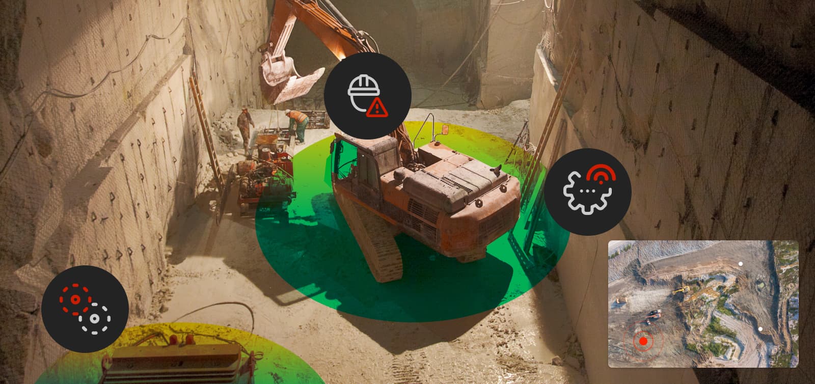
Unleash live is all about getting actionable insights from your visual data, and we are well known for real-time AI analytics on live video. However, a lesser-known component of our platform is 2D and 3D modeling.
By focusing our attention on customer workflows and delivering on efficiencies as their data grows, a natural extension to our AI offering is the ability to create rich 2D, 3D, Orthomaps, and Point Clouds from drone assets.
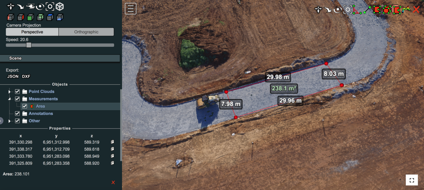
The ability to measure stockpile volumes and areas is a feature that some of our customers have been looking for to complement other modeling capabilities such as Orthomap layers, annotations, and VR.
These important measurements to estimate slopes, heights, areas, and volumes can be achieved in just a few clicks, all in your browser, with no additional software required to download and available across multiple device types.
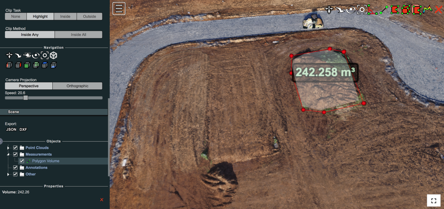
With the Smart Volume estimator feature, you draw a polygon within the point cloud, which creates a flat surface, and then Unleash Live calculates the cubic meters or cubic feet of the volume under a ‘blanket’ cast over the point cloud's surface area. This type of measurement is one of the most accurate estimates for things such as stockpiled material, gravel, sand, ore, coal, or volume of excavations, pits, and trenches.
Measuring the volume of an area on a point cloud
Our platform integrates with surveying drones, such as DJI Phantom 4 RTK, Inspires, or Mavic 2. You can achieve more accurate visual data of your site by including Ground Control Points to survey your site and achieve more valuable insights.
Detailed values can be exported to JSON or DXF files for use in ArcGIS, QGIS, or other geographical surveying or construction software.

Annotations
We recently announced the ability to annotate, draw easily, and tag assets, faults, and points of interest with custom and predefined categories. Improving the speed and quality of annotations through an intuitive data entry interface enables teams to improve communications and transparency by assessing and annotating on high-resolution and current 2D Orthomaps.
Work with the latest high-resolution snapshot of your assets, not on dated and low-resolution satellite imagery.
Get Started with Unleash live
Visit unleashlive.com to learn more, or contact us to learn how your business can take advantage of modeling, volumetrics, and live streaming.